
Local Food and Growing Maps
Page 1 of 1

Local Food and Growing Maps
![]() by Locavore Tue Aug 26, 2014 8:13 pm
by Locavore Tue Aug 26, 2014 8:13 pm
Public Lands

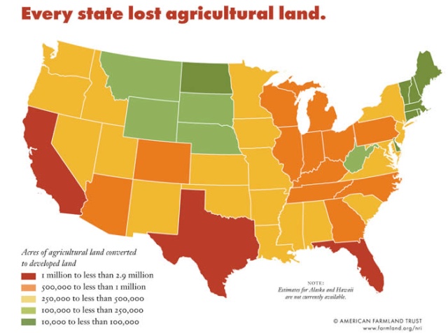
Agricultural Land lost to Development
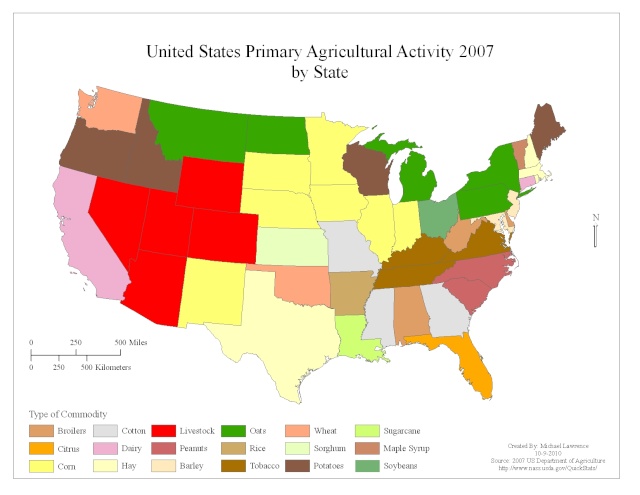
Primary Crops/Product by State
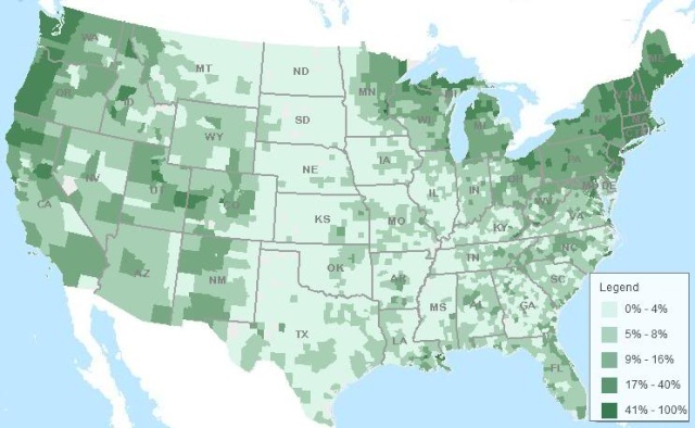
Percentage of US Land in Farms

Average Value of Agricultural Products

Pasture land Value Per Acre

Number of Farms in US

MOST IMPORTANT for Locavores: Map Showing Percent of Farms with Direct Sales for Human Consumption
MOST IMPORTANT: Map of Percent of Farms Using Community Supported Agriculture

Map: Percent of U.S. Farms with Value Added Commodities (more than one crop/secondary crops)

Plant Hardiness Zone Map - Where Longer Growing Seasons Are

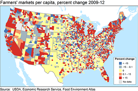
Farmers market increase and decrease
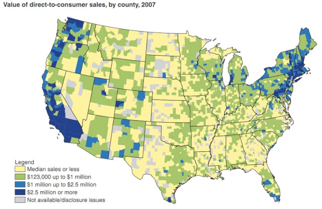
Value of direct to consumer sales
Per capita availability of farmers markets

http://www.bigpictureagriculture.com/2011/05/us-farm-data-maps-density-farm-payments.html
Agricultural Land lost to Development
Primary Crops/Product by State
Percentage of US Land in Farms
Average Value of Agricultural Products
Pasture land Value Per Acre
Number of Farms in US
MOST IMPORTANT for Locavores: Map Showing Percent of Farms with Direct Sales for Human Consumption
MOST IMPORTANT: Map of Percent of Farms Using Community Supported Agriculture
Map: Percent of U.S. Farms with Value Added Commodities (more than one crop/secondary crops)
Plant Hardiness Zone Map - Where Longer Growing Seasons Are
Farmers market increase and decrease
Value of direct to consumer sales
Per capita availability of farmers markets
http://www.bigpictureagriculture.com/2011/05/us-farm-data-maps-density-farm-payments.html

Locavore- Posts : 7
Join date : 2014-08-26
» Local Food - Some States are BETTER than Others
» Live Where Local Food Is Grown and Distributed
» Maps, Charts and Statistics 2
» Imported food from China, Not even good enough for dog food!
» Choosing A Good State To Live MAPS
» Live Where Local Food Is Grown and Distributed
» Maps, Charts and Statistics 2
» Imported food from China, Not even good enough for dog food!
» Choosing A Good State To Live MAPS
Page 1 of 1
Permissions in this forum:
You cannot reply to topics in this forum|
|
|
